

Hoteles en Alton
 Anticípate a los cambios de planesReserva hoteles con cancelación gratis.
 Elige tu opción idealBusca entre casi un millón de propiedades en el mundo.
Encuentra un hospedaje especial en Alton
Departamentos
Familias
Consulta precios para estas fechas
Esta noche
Mañana
El próximo fin de semana
En dos semanas
Nuestra selección de hoteles en Alton


1. Historic Smith Hotel B&B
Historic Smith Hotel B&BGlendale
9.2 de 10, Magnífico, (528 opiniones)
"Este alojamiento se encuentra en un pueblecito que no tiene nada mas. La habitación es pequeña, y al menos a nosotros no nos la hicieron el segundo dia. La habitación esta limpia, aunque no asi la terraza compartida a la que se podía acceder desde la habitación. Dispone de un frigorifico y microondas compartido en una habitación que usan como cocina. El desayuno era lo que te traia la mujer, sin mas opción."

Paco
El precio actual es de US$ 110
US$ 125 en total
impuestos y cargos incluidos
20 jul. - 21 jul.

2. Hatch Station Motel and Restaurant
Hatch Station Motel and RestaurantHatch
8.6 de 10, Excelente, (444 opiniones)
"De acuerdo a mi reserva el precio ya incluía taxes, Sin embargo no aceptaron esto y me volvieron a cobrar lo taxes. Hay mejores opciones mas cerca a Bryce canyon y mas económicas"

Rodolfo
El precio actual es de US$ 49
US$ 56 en total
impuestos y cargos incluidos
21 jul. - 22 jul.

3. Bryce Zion Inn
Bryce Zion InnHatch
7.8 de 10, Bueno, (556 opiniones)
El precio actual es de US$ 59
US$ 67 en total
impuestos y cargos incluidos
28 jul. - 29 jul.


4. 89 & Nine Motel
89 & Nine MotelOrderville
8.6 de 10, Excelente, (208 opiniones)
"Gran lugar para dormir y disfrutar Mt Carmel
"

Ariana Guillermina
El precio actual es de US$ 87
US$ 100 en total
impuestos y cargos incluidos
21 jul. - 22 jul.


5. Mountain Ridge Cabins and Lodging
Mountain Ridge Cabins and LodgingHatch
9.2 de 10, Magnífico, (1.000 opiniones)
"Mejor imposible. Absolutamente recomendable"
MARIA T
El precio actual es de US$ 124
US$ 142 en total
impuestos y cargos incluidos
21 jul. - 22 jul.


6. Best Western East Zion Thunderbird Lodge
Best Western East Zion Thunderbird LodgeOrderville
9.2 de 10, Magnífico, (1.002 opiniones)
"Habitacion cómoda y limpia. "
Carlos M
El precio actual es de US$ 117
US$ 134 en total
impuestos y cargos incluidos
20 jul. - 21 jul.


7. Rodeway Inn Bryce Canyon
Rodeway Inn Bryce CanyonPanguitch
8.0 de 10, Muy bueno, (1.005 opiniones)
"Para el precio es una excelente opción "
Carlos Mario
El precio actual es de US$ 43
US$ 48 en total
impuestos y cargos incluidos
6 ago. - 7 ago.


8. The Riverside Ranch RV Park, Motel & Campground
The Riverside Ranch RV Park, Motel & CampgroundHatch
9.2 de 10, Magnífico, (595 opiniones)
"Molt bona gent. Molt amables i calidesa en el tracte.
Sens dubte, hi tornaria i segur que hi estaria mes nits.
Muy buena gente. Muy amables i trato cálido.
Sin duda, volveria y estaria más noches.
Very nice people. Very kindly and warm relationship.
I will no dubt to come again and spend more nights."
Viajero anónimo
El precio actual es de US$ 123
US$ 139 en total
impuestos y cargos incluidos
12 ago. - 13 ago.


9. Bryce Canyon Pines
Bryce Canyon PinesBryce Canyon
8.0 de 10, Muy bueno, (1.005 opiniones)
"Habitación amplia buena calefacción buena ubicación cerca del parque.
Hay parqueadero y ambiente tranquilo. "
CESAR
El precio actual es de US$ 69
US$ 78 en total
impuestos y cargos incluidos
26 jul. - 27 jul.

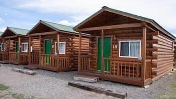

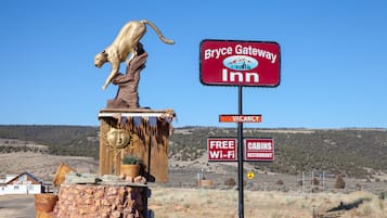
10. Bryce GatewayInn Cabins
Bryce GatewayInn CabinsPanguitch
7.8 de 10, Bueno, (883 opiniones)
El precio actual es de US$ 65
US$ 73 en total
impuestos y cargos incluidos
20 jul. - 21 jul.
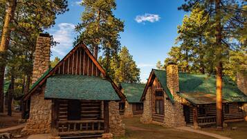
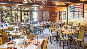


11. The Lodge at Bryce Canyon
The Lodge at Bryce CanyonBryce Canyon
8.8 de 10, Excelente, (112 opiniones)
"To be able to stay on the very edge of the Bryce Canyon, in a log cabin was a dream! I wasn't expecting much at all but was pleasantly surprised with the well kept cabins, and cleanliness. We had interconnecting cabins with our other family members so it was really great. Very suitable for an overnight.
Self parking right outside the cabins.
The restaurant was very nice, good quality meals and lovely service."

Ange
El precio actual es de US$ 183
US$ 206 en total
impuestos y cargos incluidos
15 ago. - 16 ago.


12. Arrowhead Country Cabins
Arrowhead Country CabinsMount Carmel
9.6 de 10, Excepcional, (87 opiniones)
"We enjoyed our stay at Arrowhead Cabins. The owners are very sweet and helpful. The location was great for seeing the National Parks nearby. Callie and Laura were very informative on things in the area even pointing us to a unique "Americana" museum that was with the stop. Working farm gave us fresh hard boiled eggs each morning along with baked goods."

Patti
El precio actual es de US$ 160
US$ 224 en total
impuestos y cargos incluidos
21 jul. - 22 jul.


13. Galaxy of Hatch between Bryce and Zion
Galaxy of Hatch between Bryce and ZionHatch
8.4 de 10, Muy bueno, (32 opiniones)
"Yeah, it was totally awesome. Unique. Well done for an older establishment. The ambience made our motorcycle trip complete."
Andrew
El precio actual es de US$ 79
US$ 90 en total
impuestos y cargos incluidos
28 jul. - 29 jul.


14. Duck Creek Village Inn
Duck Creek Village InnDuck Creek Village
9.4 de 10, Excepcional, (175 opiniones)
El precio actual es de US$ 189
US$ 222 en total
impuestos y cargos incluidos
20 jul. - 21 jul.


15. The Lodge at Duck Creek
The Lodge at Duck CreekMeadow View Heights
9.4 de 10, Excepcional, (98 opiniones)
El precio actual es de US$ 215
US$ 395 en total
impuestos y cargos incluidos
26 jul. - 27 jul.


16. Duck Creek Village Cabin Near National Forest!
Duck Creek Village Cabin Near National Forest!Meadow View Heights
El precio actual es de US$ 175
US$ 439 en total
impuestos y cargos incluidos
4 ago. - 5 ago.


17. Red Canyon Village
Red Canyon VillagePanguitch
6.0 de 10, (2 opiniones)
"We canceled .
It was a terrible location right on a busy hwy and RVs all over totally misrepresented on the web site
The manager said he canceled it on your end and I spoke with you virtual assistant who told me that the charges would be removed
Please expedite this matter
Thank you"
Peggy
El precio actual es de US$ 149
US$ 168 en total
impuestos y cargos incluidos
22 jul. - 23 jul.


18. Aspen Cove resort
Aspen Cove resortPanguitch
7.0 de 10, Bueno, (68 opiniones)
"Great place to stay. Family owned. Fair priced. Incredible location for lake views, fishing and boat rentals. Will return and highly recommend.
"
Antonio
El precio actual es de US$ 186
US$ 210 en total
impuestos y cargos incluidos
23 jul. - 24 jul.


19. Bryce UpTop Lodge
Bryce UpTop LodgeBryce Canyon
7.0 de 10, Bueno, (985 opiniones)
"Very good and quiet place next to Bryce Canyon Park."
veniamin
El precio actual es de US$ 90
US$ 102 en total
impuestos y cargos incluidos
25 jul. - 26 jul.


20. Between Bryce Canyon & Zion: Hiker's Paradise!
Between Bryce Canyon & Zion: Hiker's Paradise!Hatch
El precio actual es de US$ 170
US$ 322 en total
impuestos y cargos incluidos
21 jul. - 22 jul.
Precio por noche más bajo encontrado en las últimas 24 horas para una estadía de una noche para dos adultos. Los precios y la disponibilidad están sujetos a cambios. Es posible que se apliquen más términos y condiciones.

Inicia sesión y obtén un descuento promedio del 15% en miles de hoteles
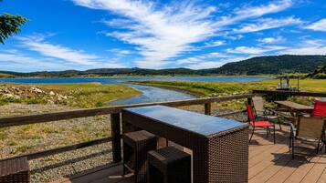
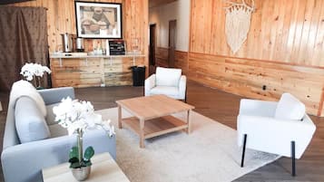
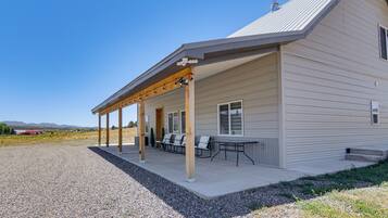
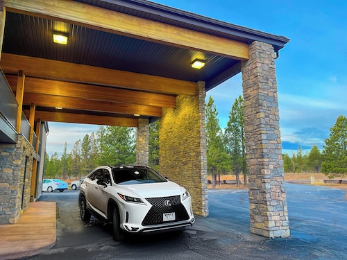
Hospédate cerca de algunas de las atracciones destacadas de Alton
Más información sobre Alton
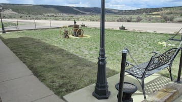
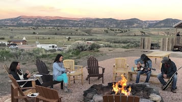
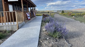
Descubre Alton: este destino te espera con paseos por senderos, vida silvestre y turismo de aventura.

Foto tomada por Eric & Kristy's Adventures
Foto de uso libre tomada por Eric & Kristy's Adventures

Estadías baratas en Alton

Rodeway Inn Bryce Canyon
3090 UT 12 Panguitch UT
Del 6 ago al 7 ago, el precio por noche es de US$ 43
US$ 43
US$ 48 en total
6 ago. - 7 ago.
impuestos y cargos incluidos
8/10 ¡Muy bueno! (1.005 opiniones)


